


WinGPS™ Marine

Deskripsi WinGPS™ Marine
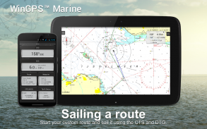
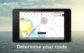
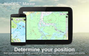
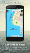
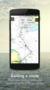
WinGPS Marine menawarkan Anda alat navigasi yang modern dan mudah dipelajari untuk perjalanan yang aman. Tekan lama pada grafik untuk merencanakan rute Anda. GPS di pesawat akan menunjukkan lokasi persis Anda. Unduh grafik ke perangkat Anda dan nikmati grafik terbaru secara offline. Hubungkan AIS Anda melalui WIFI dan cegah kemungkinan tabrakan.
Dikembangkan oleh Stentec untuk navigasi pada kapal layar dan motor, sekoci dan kano di laut, perairan pasang surut dan perairan pedalaman. Ideal saat menyewa atau mencarter perahu.
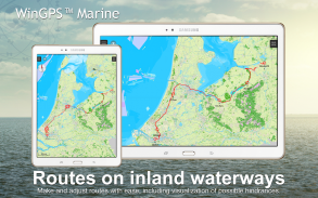
• Dukungan untuk jalur air untuk peta daratan Eropa Barat dan Donau dengan informasi jembatan, kunci dan jalur air. Dengan ini Anda dapat merencanakan dan menyesuaikan rute dengan cepat, menunjukkan hambatan apa pun. Nama saluran air dan jaraknya akan ditampilkan selama perjalanan Anda.
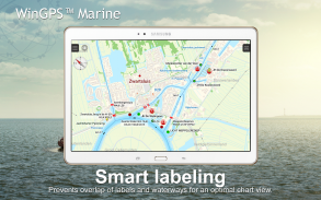
• Pelabelan cerdas mencegah label teks tumpang tindih (juga dengan saluran air) untuk mendapatkan gambar bagan yang optimal. Data jembatan dan kunci akan selalu dapat dibaca pada grafik berputar Course Up.
HIGHLIGHT
• Menavigasi grafik terkini dari Stentec, Imray, NOAA dan Delius Klasing.
• Dukungan kartu SD untuk penyimpanan grafik.
• Kelola trek, bagan, rute, dan titik arah.
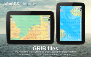
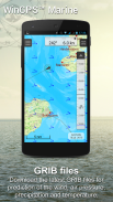
• File GRIB Dunia NOAA: angin, tekanan udara, curah hujan dan suhu.
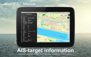
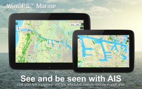
• Hubungkan AIS dan GPS melalui koneksi nirkabel WIFI atau Bluetooth.
• Mencegah tabrakan dengan vektor kecepatan kapal AIS.
• Tombol man-overboard membantu mengambil kembali awak kapal yang hilang.
• Bagan bergerak di sepanjang posisi GPS yang berada di tengah. NorthUp, CourseUp (Kelautan) atau HeadUp (Plus).
• Harmoniemodel KNMI dengan prediksi cuaca terperinci (Plus, khusus Belanda)
• Prediksi gelombang NOAA di laut terbuka (Plus, Seluruh Dunia)
Saat WinGPS Marine diinstal pertama kali, ini adalah WinGPS Marine Lite dengan fungsi terbatas. Ideal sebagai penampil grafik dengan dukungan GPS.
PEMBELIAN DALAM APLIKASI
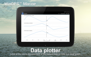
Setelah menggunakan WinGPS Marine, Anda akan membuka kemampuan penuh sistem navigasi pribadi Anda. Anda sekarang dapat merencanakan rute, mengunduh file GRIB, menyimpan trek sebelumnya dan menghubungkan AIS dan GPS. Gunakan tabel waktu praktis untuk melihat perkiraan angin, hujan, tekanan udara, dan target AIS.
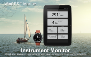
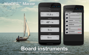
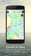
Dengan pemutakhiran WinGPS Marine Plus, Anda akan dapat menghubungkan instrumen papan tambahan melalui koneksi nirkabel ke PC papan, multiplekser, atau transponder AIS. Anda dapat menampilkan informasi terkini dan pasang surut di plotter data Anda atau melihatnya di grafik. Selain itu, model cuaca Harmonie KNMI yang canggih juga didukung serta gelombang NOAA di seluruh dunia.
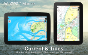
KUSTFIJN Getijmodel Rijkswaterstaat dengan prediksi angin dua hari mengenai arus, pasang surut dan ketinggian air di Waddenzee, Ijsselmeer, Markermeer, Randmeren dan Zeeland. Garis kedalaman berwarna merah membatasi saluran air yang aman tergantung pada kedalaman, pasang surut dan penyimpangan karena angin.
CAKUPAN BAGAN & PEMASANGAN BAGAN
Ketika Anda memulai WinGPS Marine Anda akan secara otomatis melihat grafik topografi default ESRI (online). Anda juga dapat mengaktifkan tangga lagu NOAA AS dan mengunduh tangga lagu dunia secara gratis melalui Manajer Bagan
Untuk navigasi yang aman, Anda dapat membeli grafik digital di www.stentec.com. Anda juga dapat membeli grafik di aplikasi atau melalui Google Play™. Grafik Anda dapat diinstal pada 3 perangkat berbeda. Misalnya saja di tablet Android, ponsel, dan laptop atau komputer Windows Anda.
Masuk dengan Akun Stentec Anda di aplikasi Marine dan unduh atau perbarui grafik DKW2 yang Anda beli di Manajer Grafik.
Misalnya saja seri DKW1800 yang populer dengan update BaZ mingguan dan NL Chart dengan update dua mingguan. Toko online kami menawarkan peta laut terkini dan semua peta daratan Europa Barat termasuk Donau.
Informasi lebih lanjut:
www.wingpsmarine.com
Kebijakan pribadi:
www.stentec.com/en/en/privacy-statement
MASUKAN PENGGUNA
Untuk peningkatan aplikasi kami sangat tertarik dengan pengalaman dan saran Anda. Silakan kirim email ke helpdesk@stentec.com.
WinGPS™ Marine - Versi 4.76
(23-04-2025)
WinGPS™ Marine - Informasi APK
Versi APK: 4.76Paket: com.stentec.wingps_marine_liteVersi Terakhir dari WinGPS™ Marine
Versi lain


Aplikasi pada kategori yang sama


Anda juga mungkin suka...


Aplikasi pada kategori yang sama


